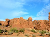
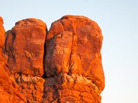
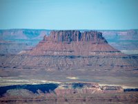
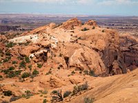
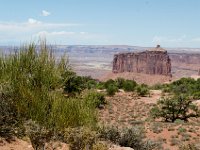
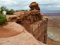
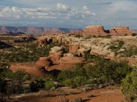
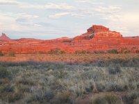
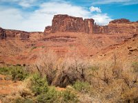
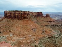
3 Rock formation viewed from the La Sal Mountains Viewpoint
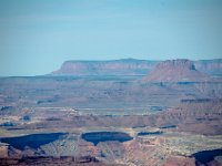
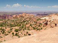
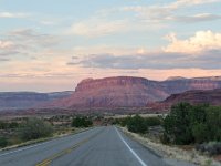
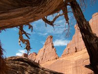
4 Unnamed rock formation just north of the La Sal Viewpoint
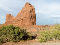
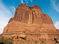
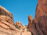
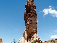
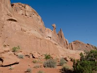
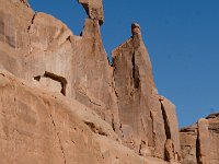
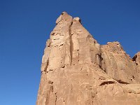
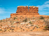
5 The Organ
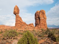
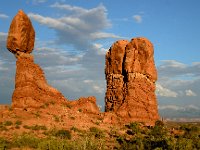
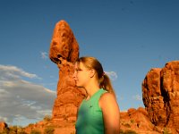
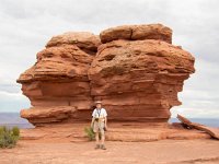
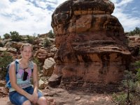
6 Balanced Rock and its neighbors (there are prople in the picture, but they are difficult to see)
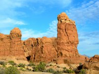
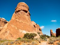
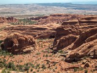
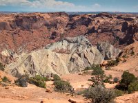
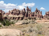
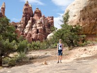
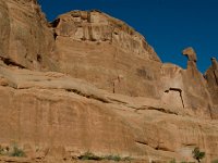
7 The Garden of Eden
8 The Garden of Eden
9 The Garden of Eden
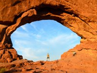
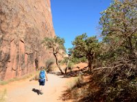
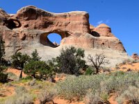
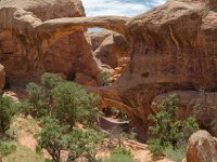
10 North and South Windows in the background
11
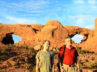
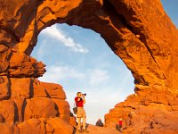
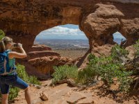
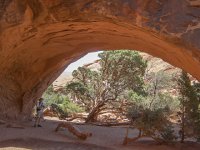
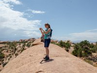
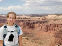
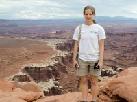
12 Teagan at the North Window
13 Richard at the North Window Arch
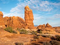
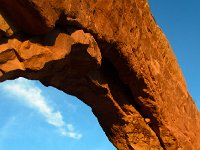
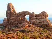
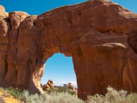
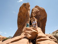
14 Turret Arch
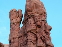
15 How many faces can you find in this picture?
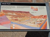
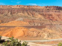
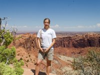
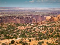
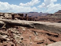
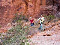
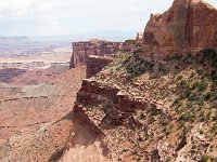
16 Marquis illustrating the 2,600-foot drop along the fault line
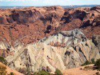
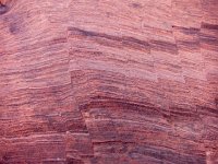
17 Looking at the geological layers (Wingate, Chinle, Moenkopi, Cutler) exposed by the Moab fault. The Navajo sandstone where we are standing would have been much higher than the top we are looking at before the quake.
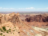
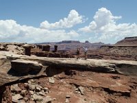
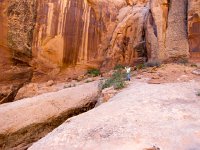
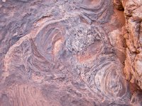
18 Another view of the Moab fault
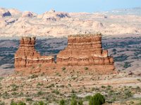
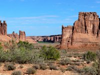
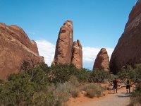
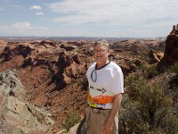
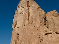
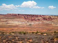
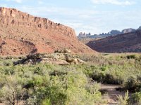
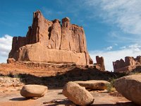
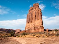
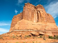
19 L to R: Three Gossips, Sheep's Rock, Courthouse Tower, The Organ
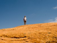
20 Let the devilish fun begin
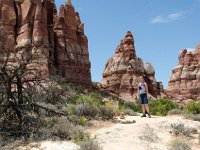
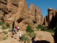
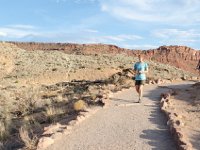
21 Teagan starting Devil's Garden Trail
22 Tunnel Arch
23 Pine Tree Arch
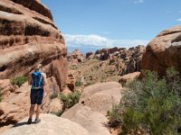
24 Devil's Garden Trail
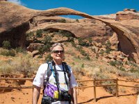
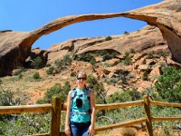
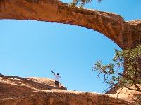
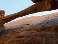
25 Richard at Landscape Arch
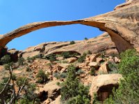
26 Landscape Arch
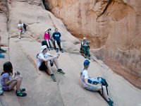
27 Teagan at Landscape Arch
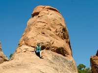
28 Teagan climbing a rock in Devil's Garden
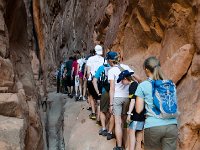
29 Devil's Garden Trail passing between fins
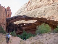
30 Partition Arch
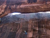
31 Trail to Navajo Arch
32 Teagan on the trail to Navajo Arch
33 Richard at Navajo Arch
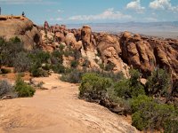
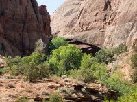
34 A view of the fin structure along the Devil's Garden Trail
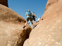
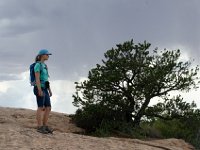
35 Teagan enjoying a view in the Devil's Garden
36
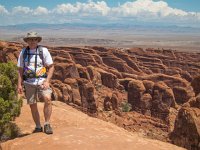
37 Teagan atop a fin
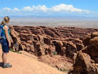
38 View from Black Rock Overlook on the Devil's Garden Trail
39 Double O Arch
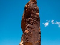
40 Dark Angel at the end of Devil's Garden Trail
41 Dark Angel at the end of Devil's Garden Trail
42 Double O Arch
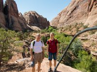
43 Teagan and Richard on a fin near Double O
44
45 Fins near the Devil's Garden Trailhead
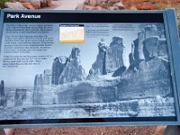
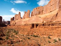
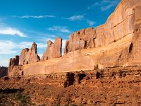
46 Marquis for Park Avenue
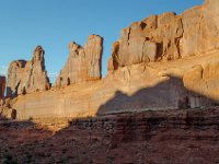
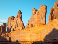
47 Park Avenue in late afternoon sun
48 Park Avenue in late afternoon sun
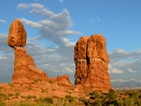
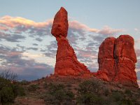
49 Balanced Rock and its neighbors in perfect afternoon lighting
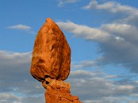
50 Balanced Rock
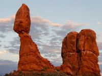
51 Balanced Rock and its neighbors in perfect afternoon lighting
52
53 Teagan striking a balanced rock pose
54 Can you find any faces in these rocks?
55
56
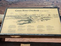
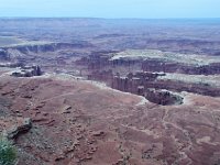
57 Green River Overlook
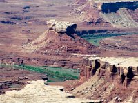
58 The Turks Head (above and right of center) surrounded by the horseshoe bend of the Green River
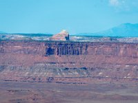
59 Cleopotra's Chair (~11 miles away) seen from Green River Overlook
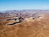
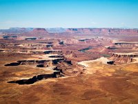
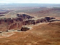
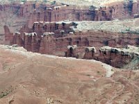
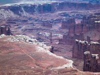
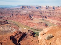
60 The Turks Head surrounded by the horseshoe bend of the Green River
61 Ekker Butte (~8 miles away) seen from the Green River Overlook in Island in the Sky
62 The Orange Cliffs (left, ~20 miles away) and Elaterite Butte (right, ~13 miles away) seen from the Green River Overlook
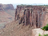
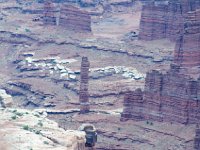
63 Ekker Butte top left, white rim sandstone lower left, Green River lower right seen from Green River Overlook in Canyonlands NP
64
65
66
67
68
69
70
71
72 View of the Green River Canyon from Upheaval Dome Trail
73 Teagan on top of the world
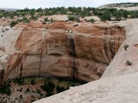
74 View of Upheaval Dome from the west rim
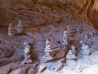
75 A rock cairn that is difficult to miss
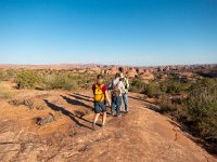
76 A butte seen looking southwest from Holeman Springs Canyon Overlook
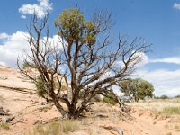
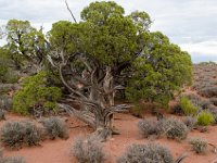
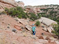
77 A Utah juniper alogn the Aztec Butte Trail
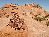
78 Teagan by a granery near the top of the first butte
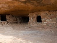
79 Granery near the top of the first butte
80 More protection from the elements for early residents of the area
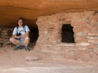
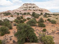
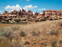
81 Aztec Butte -- our next destination
82 Working our way to the top of Aztec Butte
83 Teagan atop Aztec Butte
84 Coming down off Aztec Butte
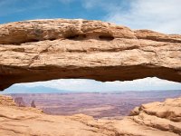
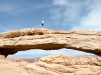
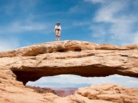
85 Teagan at Mesa Arch
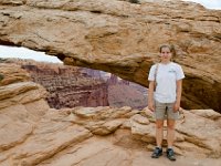
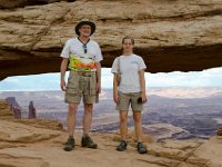
86 Richard and Teagan at Mesa Arch
87 Teagan on Mesa Arch
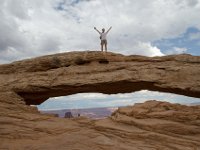
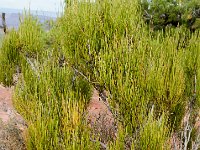
88 Morman tea (Ephedra genus) on the White Rim Overlook Trail
89 Utah juniper on the White Rim Overlook Trail
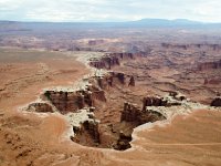
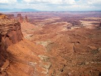
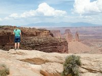
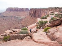
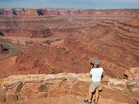
90 View from White Rim Overlook
91 Teagan at White Rim Overlook; that's about 1000 feet straight down.
92 Teagan close to the edge
93 View from White Rim Overlook
94 Richard at the end of the White Rim Overlook Trail
95 Teagan on the White Rim Overlook Trail
96 Junction Butte (left), Ekker Butte, Cleopatra's Chair (right) and Henry Mountains
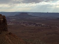
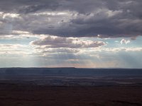
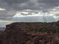
97 Interesting sky
98 View from the Green River Overlook
99
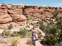
100 Let the long hike begin
101
102
103
104
105
106 "Teagan, please try to stay on the trail."
107
108
109
110
111
112
113
114
115
116
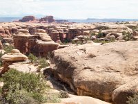
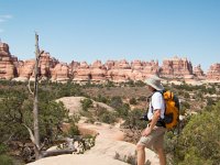
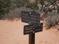
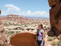
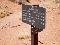
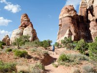
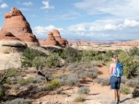
117 Beginning the Chesler Park Loop now
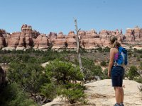
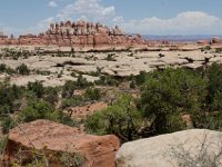
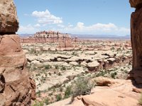
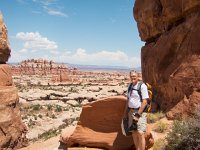
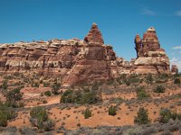
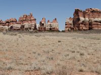
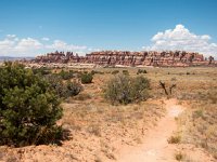
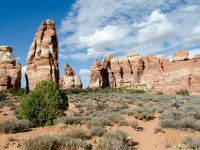
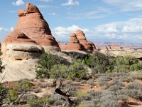
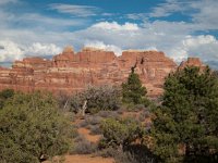
118 Chesler Park
119
120
121
122
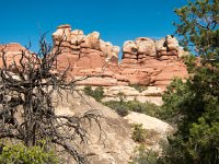
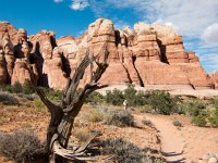
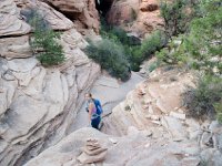
123 The Joint
124
125
126
127
128
129
130
131
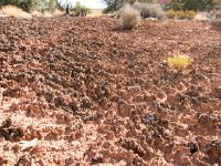
132 cryptobiotic soil
133
134
135 Leaving Chesler Park to hike back to the trailhead
136
137
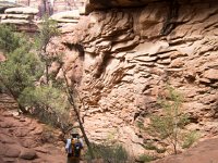
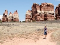
138
139
140
141 9+ hours, 11+ miles, 100+ degrees: Its good to be back!
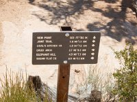
142 Pothole Point
143 View eastward toward La Sal Mountains from Pothole Point
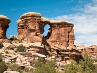
144 Wooden Shoe Arch
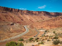
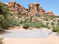
145 Scene along Hwy 211 leaving Needles District
146 Hwy 211
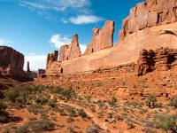
147 Park Avenue
148 Park Avenue
149 Park Avenue
150 Park Avenue
151 Park Avenue
152 Park Avenue
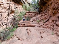
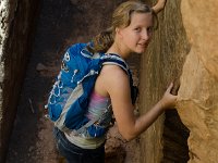
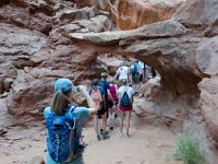
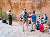
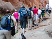
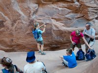
153 Guided hike in the Fiery Furnace
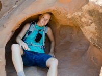
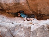
154 Teagan crawling through a narrow opening; I think this is called "Crawl Through Arch"
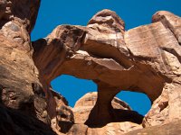
155 A double window in the Fiery Furnace (I think this is called "Skull Arch")
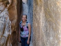
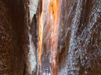
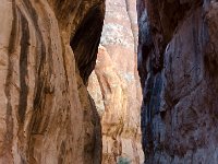
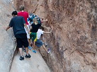
156 One of the many narrow gaps in the Fiery Furnace
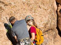
157 Ranger Todd informing the group
158 Its pretty much a follow-the-person-in-front-of-you kind of hike
159 There's not exactly a path to walk on here; this section gave hikers the most trouble
160 The sky was very clear that day
161 You need a variety of hiking techniques to make it shrough the Fiery Furnace (this is the saddle technique)
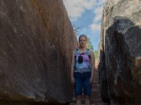
162 Lots of fins here
163
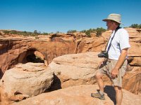
164 Ranger Todd informing the group under Surprise Arch
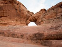
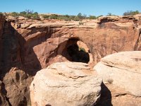
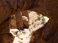
165 Surprise Arch
166
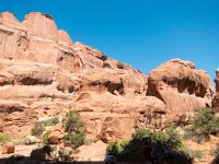
167 View of the Fiery Furnace from the main road
168
169 Ute rock art
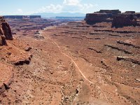
170 The trail to Delicate Arch
171 The trail to Delicate Arch is well-marked and well-traveled
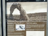
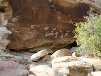
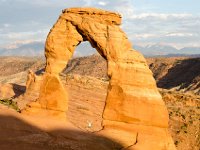
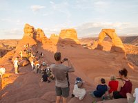
172 Delicate Arch; Teagan underneath; La Sal Mountains behind
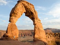
173 Delicate Arch from a different angle
174 Lots of people enjoying the late afternon view
175
176 Teagan out for a drive on Gemini Bridges Road
177
178 At Gemini Bridges
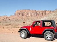
179 Richard at Gemini Bridges
180 Looking through one the Gemini Bridges
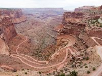
181 View of Shafer Trail from Island in the Sky
182 View of Shafer Trail from Island in the Sky
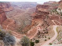
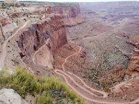
183 Switchbacks descending to Shafer Trail Road
184 Shafer Trail Road
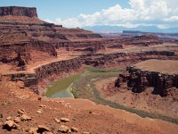
185 Colorado River at Gooseneck Overlook
186 Teagan standing on Musselman Arch on White Rim Road
187 Musselman Arch on White Rim Road; Walking Rocks in background (left)
188 Island in the Sky mesa seen from the White Rim Road
189 Island in the Sky mesa seen from the White Rim Road
190 Movie setup for The Lone Ranger along Potash Road near Thelme and Louise Point.
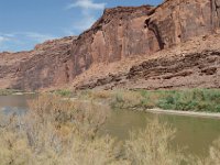
191 Colorado River along Hwy 279 near Moab.
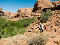
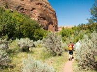
192 Hiking in the Sand Flats RA to our first rappelling point
193
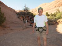
194 Richard ready for some canyoneering
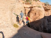
195
196
197
198
199
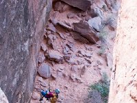
200 Richard making the first descent
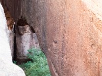
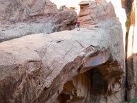
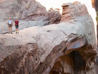
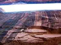
201 The 15-foot gap between the fin (on the left) and Morning Glory Bridge (right)
202
203 Exploring while we wait for the second rappel
204 Teagan at the end of Morning Glory Bridge
205
206 Teagan standing on Morning Glory Bridge
207 Teagan hovering on Morning Glory Bridge
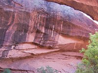
208 Morning Glory Bridge
209 Richard and Teagan on Morning Glory Bridge
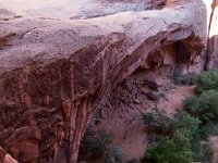
210 Morning Glory Bridge
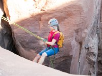
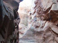
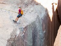
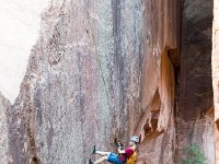
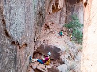
211 Teagan beginning her rappel
212
213
214
215
216
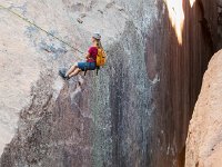
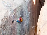
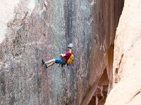
217 Teagan in a free descent
218 Richard making the 110-foot descent between the fin and Morning Glory Bridge.
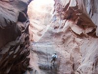
219 Safe at the canyon bottom
220 One of our classmates making the descent at Morning Glory Bridge
221 Morning Glory Bridge
222
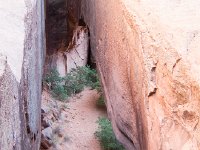
223 Hiking in Nigger Joe Canyon back to the pickup point
224 Our rappeling group hiking back
225 A typical view in Nigger Joe Canyon
226 A stop for lunch
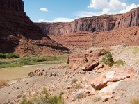
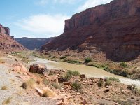
227 Scenery along Hwy 128 and the Colorado River
228 Scenery along Hwy 128 and the Colorado River
229 Scenery along Hwy 128
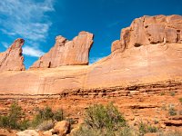
230 Park Avenue
231 Park Avenue
232 Park Avenue
233 Park Avenue
234 Park Avenue
235
236
237
238
239
240
241
242
243
244
245
246
247
248
249 Neck Spring Trail
250 Neck Spring Trail
251 Neck Spring Trail
252 Neck Spring Trail
253 Shafer Trail seen from Shafer Canyon Overlook
254 SShafer Trail seen from Shafer Canyon Overlook
255 Shafer Trail seen from Shafer Canyon Overlook
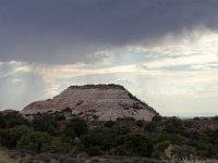
256 Aztec Butte
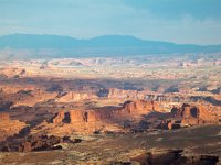
257 La Sal Mountains in background looking east from Grand View Point
258 View into Monument Basin from the Grand View Trail
259 The Grand View Point Trail (Junction Butte top left)
260 View along Grand View Point Trail
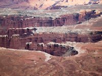
261 White Rim Road and Monument Basin seen from Grand View Point Trail
262 Junction Butte seen from Grand View Point Trail end (Elaterite Butte and Orange Cliffs in distant right background)
263 Monument Basin at dusk seen from the Grand View Point Trail
264 One of the Monuments in Monument Basin
265 Monument Basin and White Rim Trail at dusk seen from the Grand View Point Trail
266 Props for the movie The Lone Ranger
267 Props for the movie The Lone Ranger
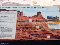
268 More geology, this time at Dead Horse Point State Park
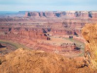
269 View from Dead Horse Point the Colorado River and Island in the Sky
270 View from Dead Horse Point of Potash Road, Colorado River, and Island in the Sky
271
272 Shopping at The Gateway
273 Our supper place in The Gateway
274 Brick oven pizza at the farmers market
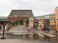
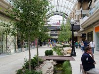
275 Brigham Young and the pioneers
276 The base and meridian used to lay out the city44
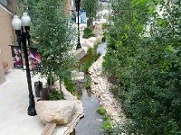
277 City Creek
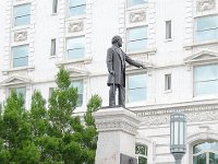
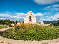
278 The City Creek Center appropriately named for the creek that runs through it
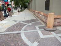
279 Its never really raining too hard for dessert
280 Inside the Morman Tabernacle
281 Flowers were everywhere
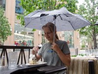
282 The LDS Conference Center
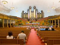
283 LDS Conference Center
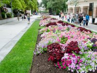
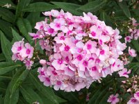
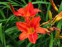
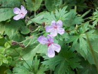
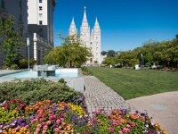
284 Joseph Smith Memorial Building
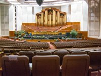
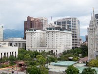
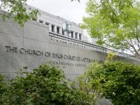
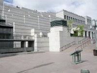
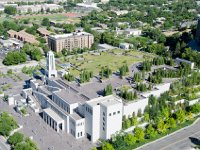
285 Church Office Building
286
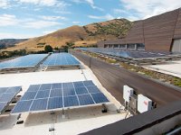
287 The green roof of the conference center
288 From the sidewalk by the conference center
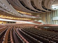
289 The conference center
290
291
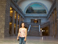
292 The Utah state capitol
293 The Eagle Gate Monument
294 The Lion House
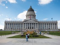
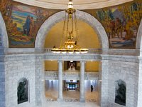
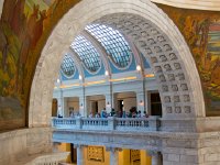
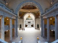
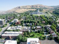
295 The tabernacle (right) and temple (left)
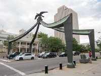
296 LDS Temple and Office Building
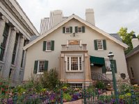
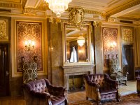
297 LDS Assembly Hall
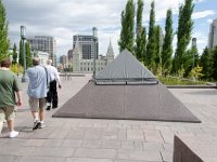
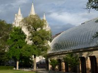
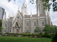
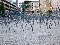
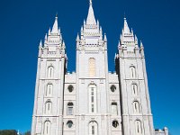
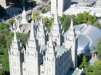
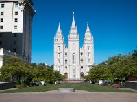
298 A sculpture garden, let's say, at 57W200S
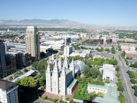
299
300
301
302
303
304
305
306
307
308
309
310
311
312
313
314
315
316
317
318
319
320
321
322
323
324
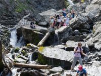
325 Doughnut Falls in Big Cottonwood Canyon
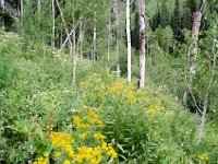
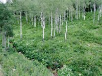
326 Mill D North Fork Trail in Big Cottonwood Canyon
327 Mill D North Fork Trail in Big Cottonwood Canyon
328 Mill D North Fork Trail in Big Cottonwood Canyon
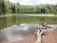
329 Dog Lake on Mill D North Fork Trail in Big Cottonwood Canyon
330 Mill D North Fork Trail in Big Cottonwood Canyon
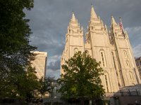
331 The temple
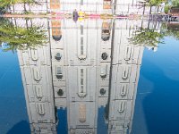
332 The temple reflected
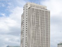
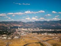
333 The state capitol seen from the top of the office building
334 The temple and tabernacle
335 View of the temple and tabernacle from the top of the office building
336 View of the conference center from atop the office building